SUGAR NOTCH TRAILS
In Sugar Notch Borough, Earth Conservancy undertook reclamation of approximately 50 acres of mine-scarred land for a residential area on a larger 189-acre site. While the reclaimed land was intended for residential development, the remaining acreage – 137 acres of pristine woodland and a section of Sugar Notch Run – were designated as green/recreational space. In EC’s Open Space Master Plan, the centralization of residential and recreational areas was encouraged. Accordingly, EC saw this as an ideal spot to create a small trail system, i.e., the Sugar Notch Trails. The adjacent Greater Hanover Area Recreation Park added to the opportunities nearby.
The Sugar Notch Trail system includes two trails of varying technical difficulty: the Ridgetop Trail and the Jacqueline Munro Trail. Trails are open from dawn to dusk. To access the trails, from I-81, take Exit 164 to S.R. 29. Then take Exit 1 (Sugar Notch) to Main Street.
- Ridgetop Trail: Utilizing an existing path, the 3.06-mile Ridgetop Trail begins at a trailhead on the Phase I section of the Greater Hanover Area Recreation Park, runs along the ridgeline of Wilkes-Barre Mountain, and ends at a second trailhead on Main Street in the west end of Sugar Notch, beside St. Mary’s/Holy Family Cemeteries. Along the trail you will cross an old railroad bridge and walk along Sugar Notch Run.
Eastern Trailhead | Turn RIGHT onto Main Street and RIGHT onto Earth Conservancy Drive / 41.198284, -75.913377
Western Trailhead | Turn LEFT onto Main Street and follow to just past cemetery on RIGHT / 41.192952, -75.944689
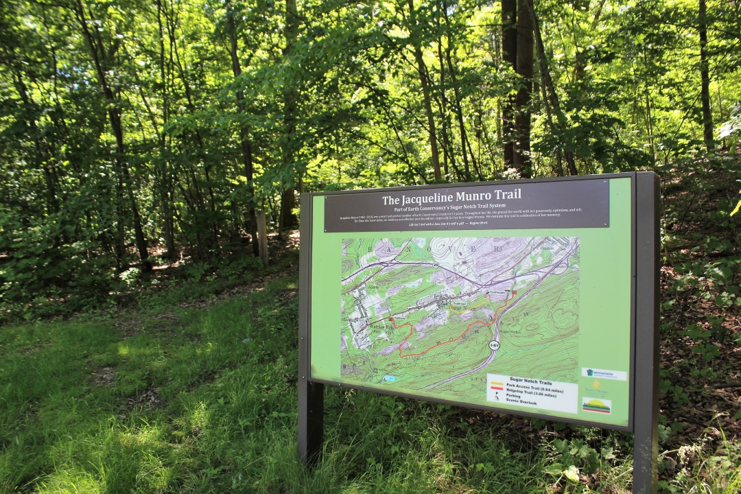
- Jacqueline Munro Trail: At 0.64 miles, the Munro Trail is a shorter walk, providing a pedestrian route between Sugar Notch and the recreation park. The primary trailhead is located off of Broadhead Avenue at Chestnut Street, in a small playground. The trail runs through the reclaimed Sugar Notch residential area to the Phase II fields.
Eastern Trailhead | Turn RIGHT onto Main Street and RIGHT onto Earth Conservancy Drive / 41.198086, -75.914916
Western Trailhead | Turn LEFT onto Main Street and LEFT onto Broadhead Avenue / 41.195882, -75.928778
Three of the trailheads have parking. Both trails are marked by blazes. Download the printable map/brochure of the Sugar Notch Trail System.
Off-Season Use: Gates may be closed after November 1. Off-season trail use poses unique risks inherent when participating in outdoor recreation activities. Users assume all risk in recreating on EC properties.
In 2017, Earth Conservancy renamed part of our Sugar Notch Trail after our late colleague, Jackie. Formerly the Park Access Trail, the Jacqueline Munro Trail features an updated sign at the trailhead, with words of remembrance from some her her closest friends. It reads: “Jacqueline Munro (1962-2014) was a smart and spirited member of Earth Conservancy’s team for 11 years. Throughout her life, she graced the world with her generosity, optimism, and wit. For those who knew Jackie, her kindness and affection were boundless – especially for her four-legged friends. We dedicate this trail in celebration of her memory.” At the end was added a favorite quote of Jackie’s from author Regina Brett: “Life isn’t tied with a bow, but it’s still a gift.”
Our thanks to Karen Warho, Janet Sweeney, Angela Vitkoski, Dr. Holly Frederick, Dr. Marleen Troy, and Julie McMonagle for their assistance with the renaming project.